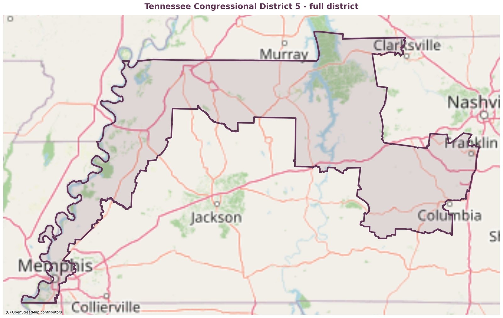
The district · District 5
They redrew the whole thing in three days.
From downtown Memphis to the edge of Middle Tennessee - 17 counties, drawn to be hard to win and hard to follow.
Are you in it?
Type your address. It checks against the new line. Nothing is saved.
Where the line does the work.
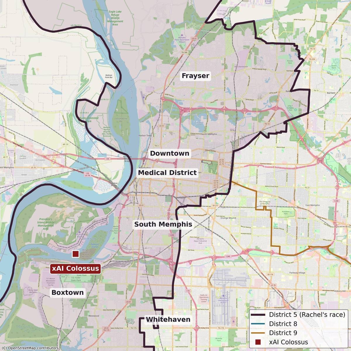
Memphis
Memphis got cut into three districts. District 5 takes downtown, the Medical District, South Memphis, and Frayser. District 8 and District 9 split the rest. The xAI Colossus site lands inside the line.
Who got put together
Memphis, two-thirds non-white, in one district with Williamson - the whitest and richest county in the state. Then fifteen rural counties between them.
| County | Non-white | Median income |
|---|---|---|
| Shelby Memphis* | 67% | $63,767 |
| Lauderdale | 42% | $49,879 |
| Montgomery* | 41% | $75,613 |
| Lake | 36% | $28,814 |
| Tipton* | 26% | $74,127 |
| Maury* | 24% | $76,130 |
| Dyer | 23% | $58,154 |
| Obion | 21% | $54,613 |
| Williamson* | 19% | $135,594 |
| Weakley | 15% | $51,880 |
| Henry | 14% | $50,613 |
| Hickman | 12% | $68,247 |
| Benton | 10% | $51,746 |
| Houston | 10% | $59,576 |
| Humphreys | 10% | $60,616 |
| Stewart | 9% | $63,114 |
| Lewis | 9% | $56,285 |
* Split county - figures are whole-county, so the in-district share differs. The Memphis part of Shelby is more heavily Black than the county overall. Census ACS 2020-2024.
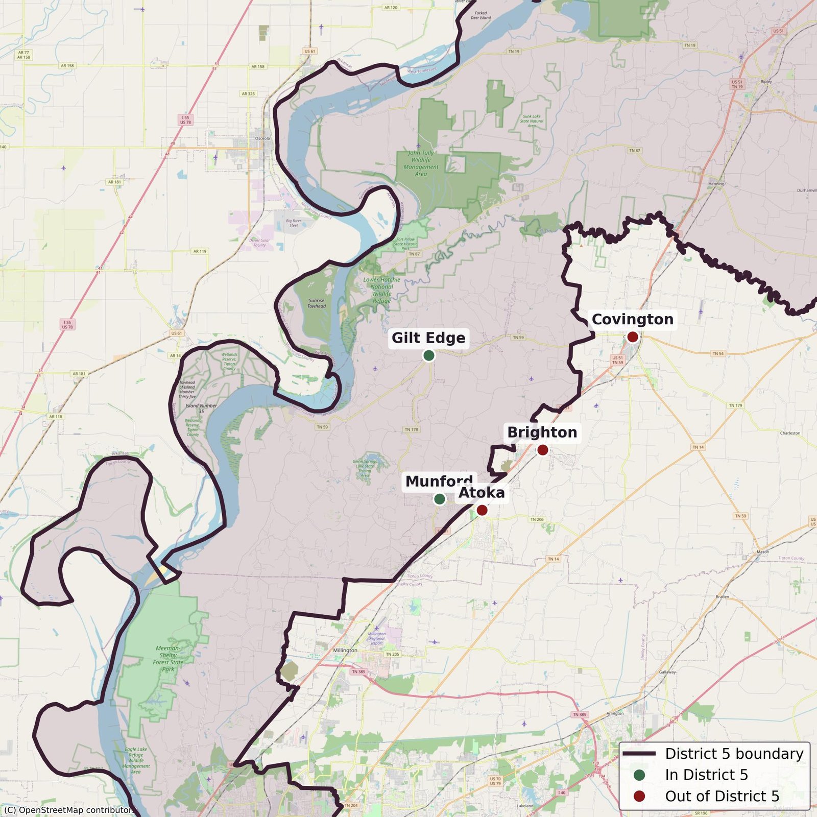
Tipton
Munford and Gilt Edge are in. Covington, the county seat, is out. So are Atoka and Brighton. Neighbors in the same county, sorted into different districts.
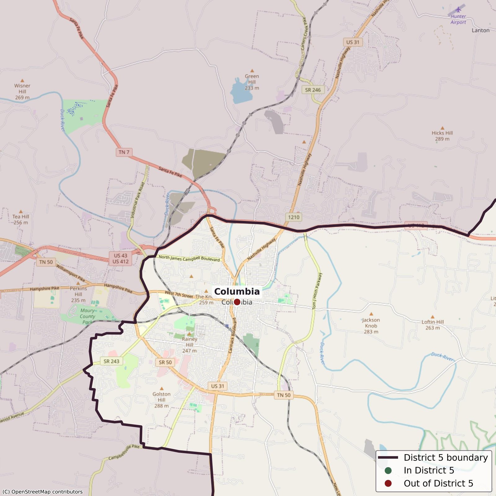
Columbia
Watch the line bend. District 5 wraps right around Columbia - the county seat and biggest city in Maury - to leave it out, while pulling in Spring Hill and Mount Pleasant on either side.
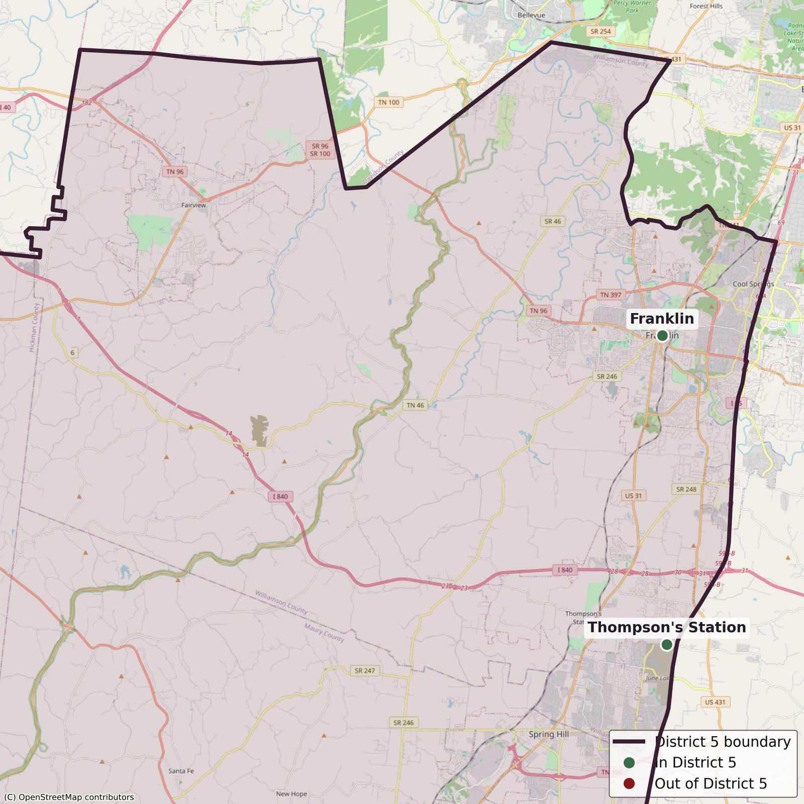
Williamson
Franklin and Thompson’s Station are in. Brentwood is out. A piece of the wealthiest county in Tennessee, carved off into the district.
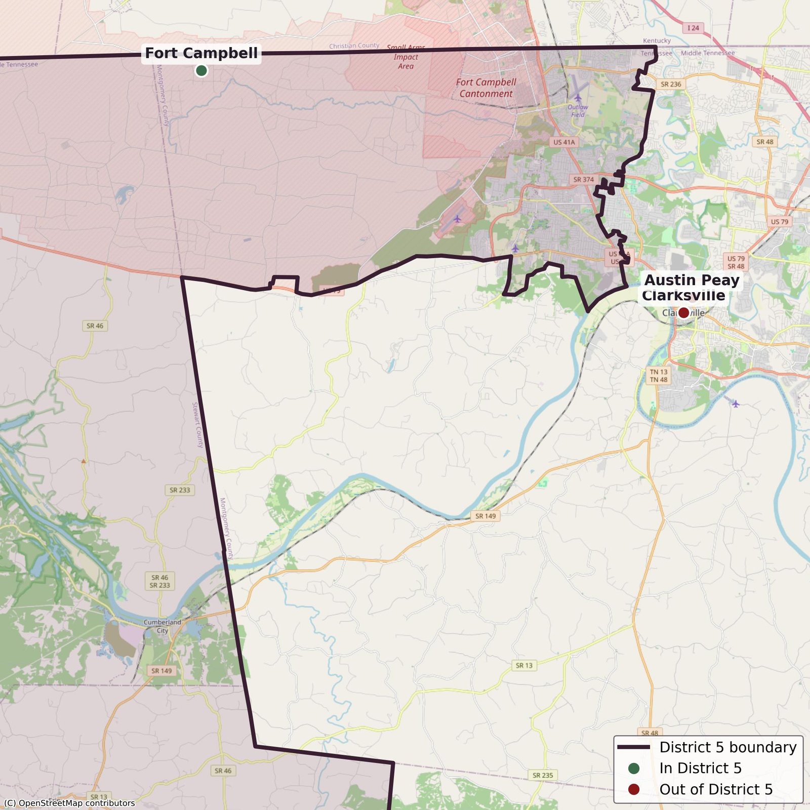
Montgomery
Fort Campbell is in. Clarksville, the fifth-biggest city in the state, sits out, along with Austin Peay. The base is split off from the town built around it.
What the state released.
This is the official District 5 map. Pages of unlabeled roads and county slivers, no plain list of who’s in and who’s out. To see what the district actually does, you have to take it apart yourself.

Boundary data: Tennessee Comptroller of the Treasury, U.S. Congressional districts adopted May 7, 2026.
Address lookup: OpenStreetMap / Nominatim. Base maps: OpenStreetMap and CARTO.